
Signs Your Shoreline Needs Stabilization
- A bank that visibly steepens or slumps a little more after every winter drawdown
- Grass or soil disappearing along the waterline near a dock or boathouse
- Exposed tree roots or a leaning tree at the top of the bank
- Cloudy water near shore after normal wave action, a sign of active soil loss
- A neighboring property with visible riprap while yours still has a bare dirt bank
- Concerns about meeting Georgia EPD buffer requirements before starting shoreline work
Sizing and Placing Riprap That Survives Wake and Drawdown
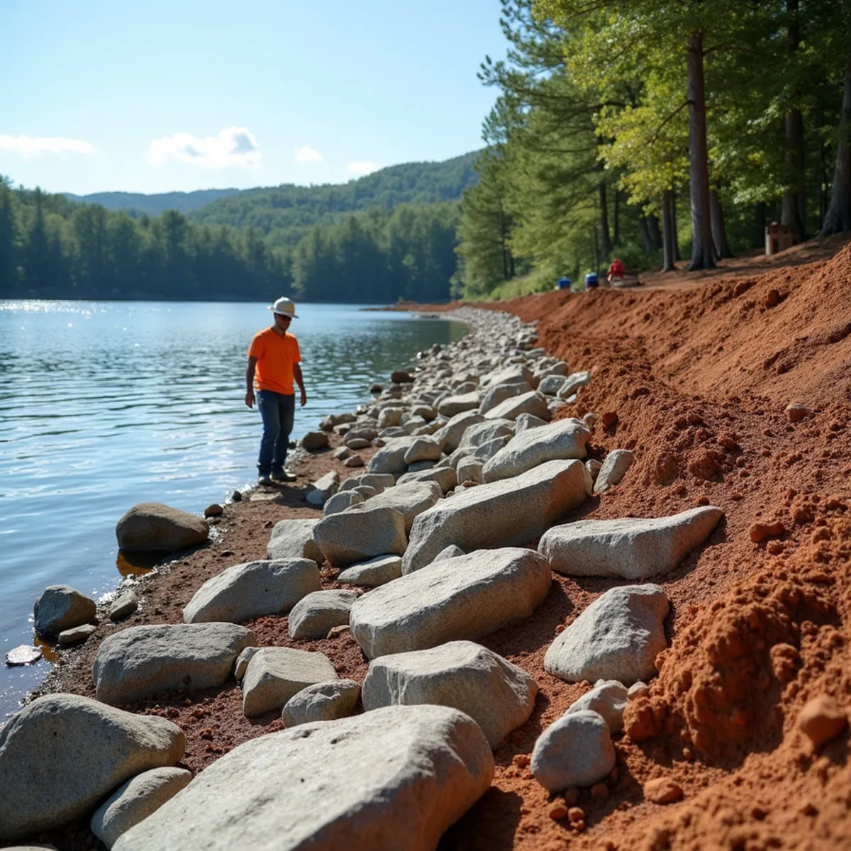
Reservoir shorelines like Burton and Rabun are not static - Georgia Power's seasonal drawdown exposes the bank to freeze, dry-out, and re-saturation cycles that grass alone cannot survive, and recreational boat traffic adds constant wake energy at the waterline. We grade the bank to a stable slope first, then place riprap sized to the exposure the shoreline actually sees: heavier armor stone on open-water or high-traffic coves, lighter graded stone in sheltered areas, always over a geotextile filter fabric layer that stops fines from washing out from underneath the rock.
Work below the normal pool elevation on a Georgia Power reservoir falls under shoreline management guidelines, and any work affecting the state waters buffer is subject to Georgia EPD rules, so we confirm the property's shoreline management permit status and buffer distance before equipment ever touches the bank. Where the bank feeds runoff from higher on the lot, we tie the grading into red clay drainage work so water is directed to a stable outlet instead of sheeting straight down the new rock.
- Bank re-graded to a stable, engineered slope before rock placement
- Riprap sized to wake and current exposure at that specific shoreline segment
- Non-woven geotextile fabric placed beneath all rock to prevent fines washing out
- Confirmation of Georgia Power shoreline management permit status before work begins
Access, Equipment, and Long-Term Bank Health
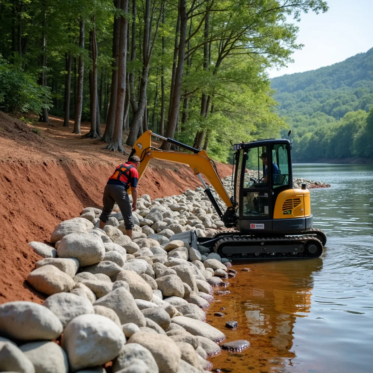
Most lakefront lots around Clarkesville and Lakemont are steep from the road down to the water, so equipment access is planned before rock is ever ordered - we use compact excavators staged on the bank itself or barge-delivered stone where road access will not support a standard dump truck. Stone is placed by hand-guided excavator bucket to key each piece against its neighbors rather than dumped loose, which is what keeps a riprap bank from sliding downhill as one sheet during the first hard winter.
Once the armor stone is set, we finish-grade the top of bank transition and, where it fits the property, add native shoreline plantings above the rock line to root the soil further and soften the look from the water. This is the same stabilization approach we use for properties throughout Lakemont and the broader lake communities feeding Habersham and Rabun counties, and it is the permanent fix behind our emergency shoreline collapse response when a bank has already failed.
- Compact excavator or barge-delivered stone for steep or water-only access
- Hand-guided, keyed rock placement rather than loose-dumped stone
- Top-of-bank grading transition finished to shed water away from the new rock
- Native shoreline planting above the riprap line where appropriate
Permit Coordination and Rock Engineering Specifics
Georgia Power's shoreline management guidelines on Lake Burton and Lake Rabun generally require a permit application before any grading or stone placement below the full pond elevation, and Georgia EPD's state waters buffer typically extends 25 to 50 feet from the shoreline depending on the water body and local variance history - we pull the specific requirements for each parcel rather than assuming a blanket distance, since getting this wrong can mean a stop-work order mid-project. We handle the permit application paperwork directly rather than leaving it for the homeowner to navigate alone.
Riprap sizing follows a rock weight and diameter calculation (commonly referenced as D50 median stone size) driven by wave height, wind fetch across open water, and boat wake frequency for that specific cove or point - a sheltered cove behind a peninsula needs meaningfully smaller stone than an open-water point that catches wake from three directions. We stage stone delivery by tandem dump truck where road access supports it, or by barge with a small excavator mounted on a floating platform where the lot is water-access only, which is common on the steeper Lake Burton and Lake Rabun frontage around Clarkesville.
- Georgia Power shoreline permit application filed before grading below full pond elevation
- EPD state waters buffer distance confirmed per parcel, typically 25 to 50 feet
- Riprap sized by D50 median stone weight matched to wave height and wake exposure
- Barge-mounted excavator staging for water-access-only lots
Our Process
- 1
Shoreline Site Inspection
We walk the bank at current pool level, assess exposure and existing erosion, and check permit status before quoting.
- 2
Grading Plan & Rock Sizing
We select riprap size and quantity based on wake exposure, bank height, and how the shoreline drains from above.
- 3
Access & Delivery Planning
We determine whether stone comes in by land or barge based on the lot's slope and road access.
- 4
Bank Grading & Rock Placement
We regrade the bank, lay filter fabric, and place and key riprap by hand-guided excavator.
- 5
Finish Grading & Planting
We complete the top-of-bank transition and add shoreline planting where it suits the property.
Materials & Equipment
- Graded riprap and armor stone sized to wake exposure
- Non-woven geotextile filter fabric
- Compact excavators suited to steep bank access
- Barge delivery equipment for water-access-only lots
- Native shoreline grasses and shrubs for bank planting
What Affects Your Price
Every mountain and lakefront project is different. These are the factors we weigh in a free on-site estimate — no fixed price fits every property.
- Linear feet of shoreline and average bank height being stabilized
- Wake and current exposure, which determines riprap size and tonnage
- Land versus barge delivery of stone based on site access
- Existing erosion severity and volume of regrading required
- Georgia Power shoreline permit and EPD buffer coordination
- Optional native planting above the riprap line
Why Choose Kipps Kustom Landscapes for Lakefront Shoreline Stabilization
We Handle Georgia Power and EPD Permits In-House
Shoreline work on Lake Burton, Lake Rabun, and Seed Lake requires navigating Georgia Power shoreline management guidelines and Georgia EPD buffer rules; we file and coordinate that paperwork ourselves rather than leaving homeowners to figure out state and utility permitting on their own.
15+ Years on These Specific Reservoirs
Since founding the company in 2010 we have stabilized shoreline on Lake Burton, Lake Rabun, and Seed Lake frontage, so we already know how each reservoir's drawdown schedule and wake pattern behaves before we ever walk a new property.
Our Own Excavators, Staged by Land or Barge
We own and operate the compact excavators used for both land-access and barge-delivered stabilization jobs, which means scheduling is not held hostage to a rental yard's availability during peak lake season.
Free On-Site Inspection at Current Pool Level
We walk your bank at the current pool elevation and give you a written line-item scope covering rock, fabric, grading, and permit coordination before any stone is ordered.
Frequently Asked Questions
- Work below the normal pool elevation on a Georgia Power reservoir generally requires a shoreline management permit, and buffer areas are also regulated by Georgia EPD. We confirm your property's specific permit status and handle the paperwork before any stone is placed.