
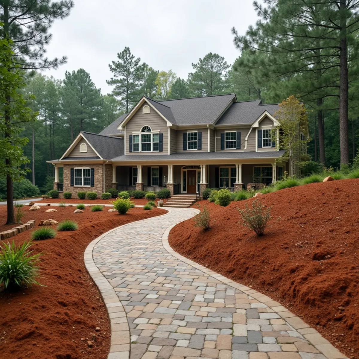
Ridge Terrain Shaped by the Railroad Cut
The rail corridor through Lula follows the path of least resistance across Hall County's ridge terrain, and residential lots on either side of that corridor often carry the same steep elevation change the railroad grade had to be engineered around. A lot that looks buildable on a plat map can turn out to have fifteen or twenty feet of elevation drop from the street to the back property line, which changes every decision about where a driveway, walkway, or patio can reasonably go.
We start Lula projects with an actual elevation survey of the lot rather than working off eyeballed slope estimates, because a stabilization or walkway plan built on a guessed grade often needs expensive rework once real elevation numbers come in during excavation.
Stabilizing Ridge Slopes
Ridge lots shed water fast during heavy rain, and unstabilized cut banks along a ridge slope erode visibly within a season or two, undermining anything built above them. We stabilize these slopes with a combination of boulder retaining walls at key elevation breaks and erosion control fabric with native ground cover plantings on sections too broad or gradual to justify a full wall, which keeps the whole slope system working together instead of relying on one method to do everything.
Where ridge lots border the rail right-of-way, we also coordinate setback awareness with the property owner, since work too close to railroad property lines can trigger additional approval requirements that are worth checking before any excavation begins.
Interlocking Pavers for Elevation Change
A straight concrete walkway does not work well on Lula's stepped ridge lots, since a rigid slab cannot accommodate the kind of elevation change these properties carry without either an impractically long ramp or an unsafe grade. We build interlocking paver walkways with integrated steps at the actual grade breaks, using a compacted aggregate base under every section so the pavers do not shift or settle unevenly as the ridge soil moves seasonally with moisture.
Interlocking pavers also have a practical advantage on these lots beyond looks, individual pavers can be lifted and reset if an isolated section settles, rather than needing to break out and repour an entire concrete run, which matters on ridge terrain where some settling over time is close to unavoidable.
Lula Between Gillsville and Cornelia
Lula sits close to Gillsville and Maysville, and within easy range of Cornelia as well, so we schedule Lula work efficiently alongside jobs in those areas. For a full ridge lot buildout we typically combine slope stabilization, paver walkways, and red clay drainage work into a single sequenced plan.
Planting Into Disturbed Ridge-Cut Soil
Grading a ridge lot in Lula often exposes subsoil that has never supported plant life, since the topsoil that existed before a house pad or driveway was cut into the slope frequently ends up pushed downhill or hauled off entirely during construction. Ornamental beds and foundation plantings installed straight into that exposed subsoil struggle regardless of how carefully the plants themselves are chosen, because the soil structure simply is not there yet. We rebuild a real topsoil layer on these cut sections before planting, blending compost and topsoil to a depth that gives new root systems something to actually grow into.
This kind of ridge-lot rebuild comes up often enough on Lula properties that we usually recommend folding it into a full mountain landscape design and build scope alongside the slope stabilization and paver walkway work, since soil rebuilding, retaining structure, and hardscape all interact on a lot with this much elevation change. Where the cut bank borders the rail right-of-way, we also favor deep-rooted native grasses over ornamental groundcover on that exposed slope, since their root mass holds disturbed soil in place better during the first few seasons after grading. We test drainage on the rebuilt soil profile before any final planting goes in, since a topsoil blend that looks right on the surface can still perch water on top of the compacted ridge clay underneath if it was not tied into the surrounding grade correctly.
Neighborhoods and Terrain Across Lula
Lula's character splits along the same lines the railroad cut through generations ago. Lots close to the historic rail corridor and downtown tend to carry the steepest elevation change, the fifteen-to-twenty-foot drops we plan stepped paver walkways around, while properties further out toward Gillsville and Maysville flatten into more typical Hall County Piedmont ground with fewer retaining wall needs and more standard drainage work.
We ask exactly where a Lula property sits relative to that rail corridor before estimating a job, since a ridge-cut lot near the tracks needs the elevation survey and stepped hardscape approach we use throughout town, while a flatter parcel out toward Gillsville is a more conventional grading and French drain job.
What a Typical Lula Ridge-Lot Project Looks Like
A typical Lula project starts with a homeowner who bought a lot on the strength of its view or its price, only to discover during design that the real elevation drop from street to backyard is far more than the plat map suggested. We survey the actual grade first, then plan retaining structure at the key elevation breaks and a stepped paver walkway connecting the levels, rather than trying to force one continuous slope to work.
The finished sequence usually runs slope stabilization with boulder retaining walls, soil rebuilding on any cut section exposed during grading, then the paver walkway and steps last, once the structural work behind it is settled and no longer likely to shift the finished surface above it.
Utility coordination adds another layer to a typical Lula ridge-lot project, since a steep grade change between the street and the house pad often means power, water, and sometimes gas lines have to be routed along or through the same slope we are stabilizing with retaining structure. We sequence excavation for those utility runs before backfilling any wall footing, coordinating with the relevant utility providers so a line does not end up buried under finished stonework that would need to be torn out to access it later. This kind of upfront coordination matters more on Lula's ridge-cut lots than it would on flatter ground, since correcting a utility conflict after a paver walkway or boulder wall is finished means undoing structural work rather than just digging a simple trench.
Our Services in Lula
Every core Kipps Kustom Landscapes service is available to Lula property owners:
Why Lula Residents Choose Kipps Kustom
Elevation Surveys Before We Ever Quote a Lula Slope
A Lula plat map can hide fifteen or twenty feet of real drop. We survey actual elevation on every ridge lot before pricing a walkway or wall, so the quote matches the ground, not a guess.
Just 15 Miles From Clarkesville
Lula is one of the closer Tier 2 communities we serve, which means quick scheduling for both the initial estimate and any follow-up work on a stepped paver walkway.
Licensed and Insured for Rail-Adjacent Excavation
Work near the Norfolk Southern right-of-way can carry extra setback requirements. Miller Landscaping Group LLC's license and insurance mean that coordination is handled correctly, not skipped.
15+ Years, 4.9 Stars, 47 Reviews Strong
Over 15 years building slope stabilization and paver work across ridge terrain like Lula's has earned a 4.9-star rating from 47 North Georgia homeowners.
Lula Landscaping FAQs
- Lula's terrain follows the same ridge cuts the railroad corridor was originally engineered around, so plat maps can understate real elevation drop across a lot. We recommend an actual elevation survey before finalizing any hardscape plan.