
A Foothills Corridor With Real Elevation Change
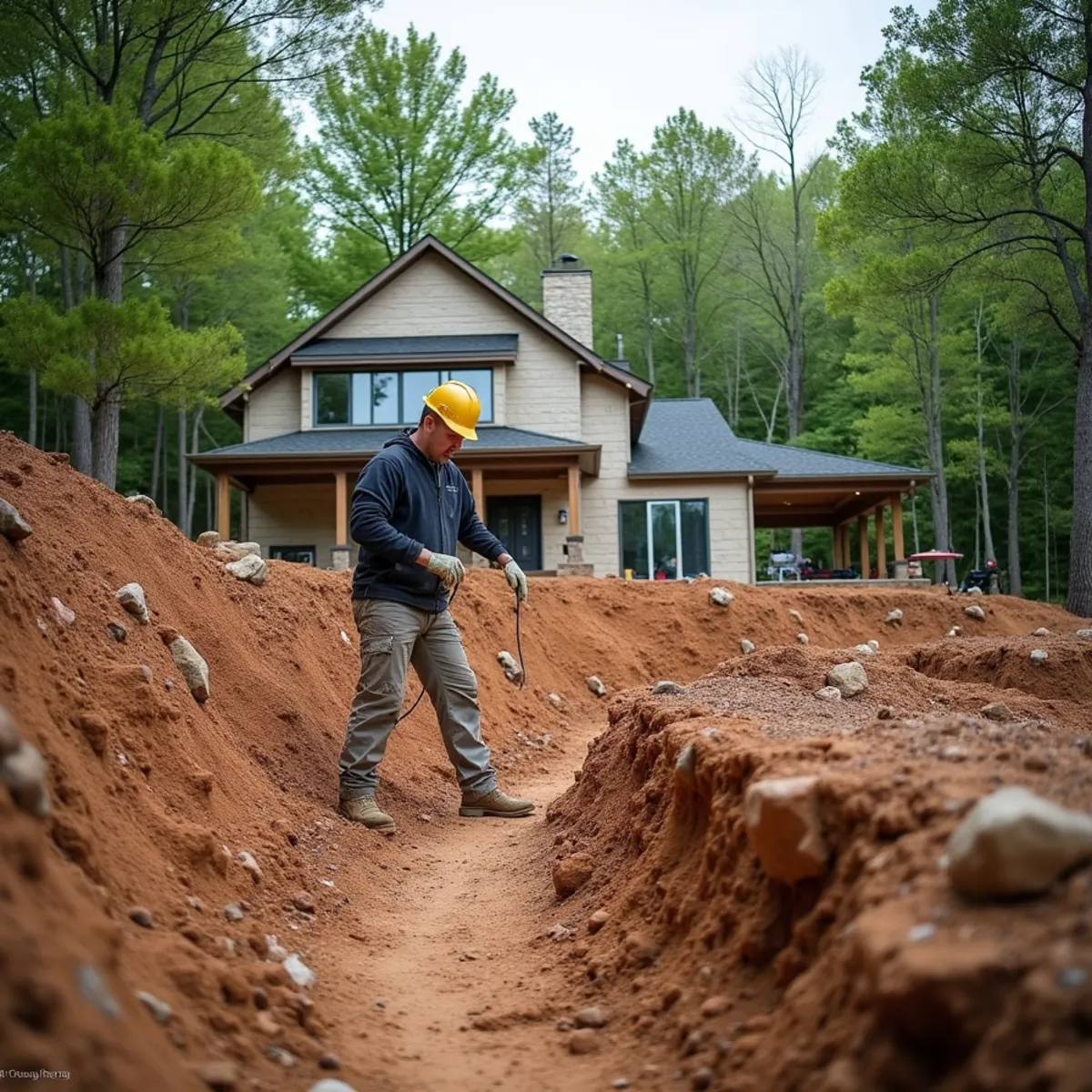
Dawsonville is the gateway most visitors drive through on the way up Highway 52 to Amicalola Falls State Park, and that same topography, ridges rising quickly out of the Etowah River valley, shapes every residential lot in the surrounding foothills. Subdivisions built into these slopes over the last fifteen years often required significant cut-and-fill grading just to create a level house pad, which leaves exposed clay banks on the property that are far steeper than anything natural erosion would have created. Left alone, those cut slopes shed sheet erosion into yards and driveways every time it rains hard, which happens often given how much orographic lift this foothill corridor gets compared to flatter ground to the south.
Why Geogrid Reinforcement Matters on These Grades
A dry-stacked boulder wall relies on its own mass and batter to resist the soil pressure behind it, and that works fine up to a point. Once a Dawsonville retaining wall needs to hold back more than about four feet of steep, saturated red clay, gravity alone is not enough, and that is where geogrid reinforcement changes the engineering. We lay geosynthetic grid in horizontal layers back into the compacted soil behind the wall as we build each course of boulders, effectively turning the soil mass itself into part of the retaining structure instead of just something the wall has to fight. This lets us safely build taller boulder-retaining-walls on Dawsonville's steep foothill lots than a standard gravity wall could support, without the wall bulging or rotating forward once hydrostatic pressure builds up after a heavy rain.
We also install drainage behind every reinforced wall as standard practice, since the geogrid does the structural work but a wall with no way to relieve water pressure behind it will eventually fail regardless of how well the grid was installed. A perforated drain pipe wrapped in filter fabric and bedded in clean gravel runs the full length of the wall base, daylighting well clear of the structure.
Managing Runoff on Steep Cut Slopes
Beyond the retaining walls themselves, Dawsonville's foothill lots need runoff management at the top of every cut slope, not just at the bottom. We install diversion swales along the crest of exposed banks to intercept water before it ever reaches the slope face, paired with red-clay-drainage-french-drains where a driveway or house pad sits below the grade change. Skipping the crest diversion is a common mistake we see from prior contractors, since it treats the symptom at the bottom of the slope while ignoring the water source coming from above.
Serving Dawsonville and the Amicalola Corridor
We also serve nearby Dahlonega and Murrayville, both of which share the same transitional foothill geology where Piedmont clay starts giving way to true mountain ground.
Wildlife Pressure and Plant Selection on Foothill Lots
Dawsonville's foothill lots back up against a mix of national forest edge and undeveloped ridge land, and that proximity brings real wildlife pressure into what would otherwise be a straightforward foundation planting plan. Deer browse tender ornamentals hard on these lots, and black bear activity, common enough in this part of Dawson County during spring and fall, means we also think about what a landscape plan puts within easy reach of a bear moving along a wooded property line, fruit-bearing shrubs and unsecured compost areas both draw more wildlife traffic than homeowners expect.
We steer Dawsonville foundation beds toward deer-resistant species that also do not actively attract bear activity, boxwood, holly, and ornamental grasses over fruiting shrubs planted close to the house, and we place any composting or edible garden areas with more distance from the home than a flatland landscape plan would typically call for. Because this palette still needs regular shaping to hold its structure through a full growing season, we offer estate-grounds-maintenance-pruning on a recurring schedule for Dawsonville foothill properties, catching browse damage and pruning needs before either one gets ahead of a homeowner who is not out checking the beds daily.
For newly graded cut slopes that still need temporary cover while permanent plantings establish, we also select erosion control seed blends that deer show little interest in grazing, since a slope reseeded with a palatable cover crop can get grazed bare again before its root system has done any real erosion control work. This matters most in the first sixty days after grading, when a slope's new seed has not yet developed enough root mass to survive repeated browsing on top of ordinary weather exposure.
Neighborhoods & Areas We Serve in Dawsonville
Dawsonville's landscaping needs split along elevation and proximity to Highway 52 and Highway 400. Subdivisions closer to the GA 400 corridor and the 30534 ZIP core sit on gentler, more suburban grade with needs closer to what we see in Dawsonville's foothill neighbor Murrayville, leaning on zoysia-sod-soil-remediation more than retaining structure, while lots further up toward Amicalola Falls climb into the steep, cut-slope terrain covered in the sections above and need the full geogrid-reinforced wall approach far more often.
Rural acreage on the outskirts, bordering national forest land, tends to need storm-debris-clearing-forestry-mulching before any building pad or landscape plan can move forward, since a lot of this ground has never been cleared beyond the original timber harvest decades ago.
Permits, Codes & Compliance in Dawson County
Dawson County requires erosion and sediment control permitting for land-disturbing activity above the state's acreage threshold, and a retaining wall built past roughly four feet typically needs an engineer's stamp before the county will issue a permit, a threshold that comes up often on Dawsonville's steep foothill cut slopes. We confirm the current requirement with the Dawson County building department before finalizing any geogrid-reinforced boulder-retaining-walls design paired with red-clay-drainage-french-drains behind it, since a wall built without the correct approval can be flagged during inspection.
Because a share of Dawsonville's steep lots also border Chattahoochee National Forest land near Amicalola Falls State Park, some grading work intersects with additional setback considerations near that boundary, and we check those lines early rather than after equipment is already on site.
Our Services in Dawsonville
Every core Kipps Kustom Landscapes service is available to Dawsonville property owners:
Why Dawsonville Residents Choose Kipps Kustom
Geogrid Engineering for Real Elevation Change
Dawsonville's foothill lots often need a wall taller than gravity alone can hold. We lay geosynthetic grid into the compacted soil behind every course of boulders once a wall passes about four feet, turning the soil mass itself into part of the structure.
40 Miles Into True Foothill Terrain
At 40 miles from Clarkesville, Dawsonville marks where Piedmont clay starts giving way to genuine mountain ground, terrain our crews are built for regardless of which side of the county line it falls on.
24/7 Response When a Cut Slope Fails
A saturated cut bank near Amicalola Falls can slide fast after a heavy rain. We run 24/7 emergency response for washouts on these foothill grades, not just scheduled installation work.
15+ Years Building for Bear and Deer Pressure
Fifteen-plus years in Northeast Georgia has taught us which foundation plantings hold up against Dawson County wildlife pressure and which ones just become a seasonal replacement bill.
Dawsonville Landscaping FAQs
- Once a wall needs to hold back more than roughly four feet of steep, saturated clay, gravity from stacked stone alone is not reliable. We add geogrid reinforcement layers into the compacted soil behind the wall for anything taller or under heavier load, which is common on Dawsonville's foothill lots.